|
|
 |
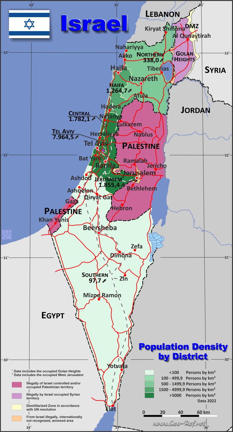
Country map - Administrative structure - Population density of Israel
Israel - Click on the map to get a enlarged image in PDF format! Other language versions are easy to generate, the description is in an own layer
Statistical Data - Population density according to the administrative structureThe population data in the table below is an estimation for 2020, based on the census data from 2008. The data of Jerusalem and the Northern District contain populations living in the occupied areas. Click on the column header brings the table in order of the column header. The default order is the District name.
|
||||||||||||||||||||||||||||||||||||||||||||||||||||||||||||||||||||||||||||||||||||||||||||||||||||||||||||||||||||

 |
If you have suggestions to include other information or you find missed links, please inform us! Click here ... |
International Border disputes
Expand list
Land boundaries
Maritime boundaries
See also neighboring states
Cyprus - Egypt - Golan Heights - Jordan - Lebanon - Northern Cyprus - Palestine - Saudi Arabia - Syria
Fast selection
List of international
organisations
and treaties
Existing
thematical maps
Poulation density for 2020
Link-Collection
Country data
German Ministry
of Foreign Affairs
International data
Special data
External links change quickly - If you get a link error - Please inform us!