|
|
 |
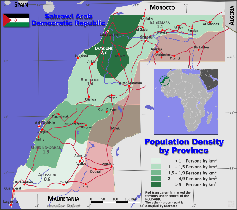
Country map - Administrative structure - Population density of Sahrawi Arab Republic
Sahrawi Arab Republic - Click on the map to get a enlarged image in PDF format! Other language versions are easy to generate, the description is in an own layer
Statistical Data - Population density according to the administrative structureThe population data in the table below is a estimation for 2007. The information about the Republic Sahrawi is very difficult, there are not so much detailed information. As source we have used mainly Spanish sources and other third internet information. Click on the column header brings the table in order of the column header. The default order is the Province name.
|
||||||||||||||||||||||||||||||||||||||||||||||||||||||||||||||||||||||||||||||||||||||||||||||||||||

 |
If you have suggestions to include other information or you find missed links, please inform us! Click here ... |
International Border disputes
Expand list
Fast selection
List of international
organisations
and treaties
Existing
thematical maps
Poulation density for 2007
Link-Collection
Country data
MINURSO - UN Status Western Sahara
International data
Special data
External links change quickly - If you get a link error - Please inform us!