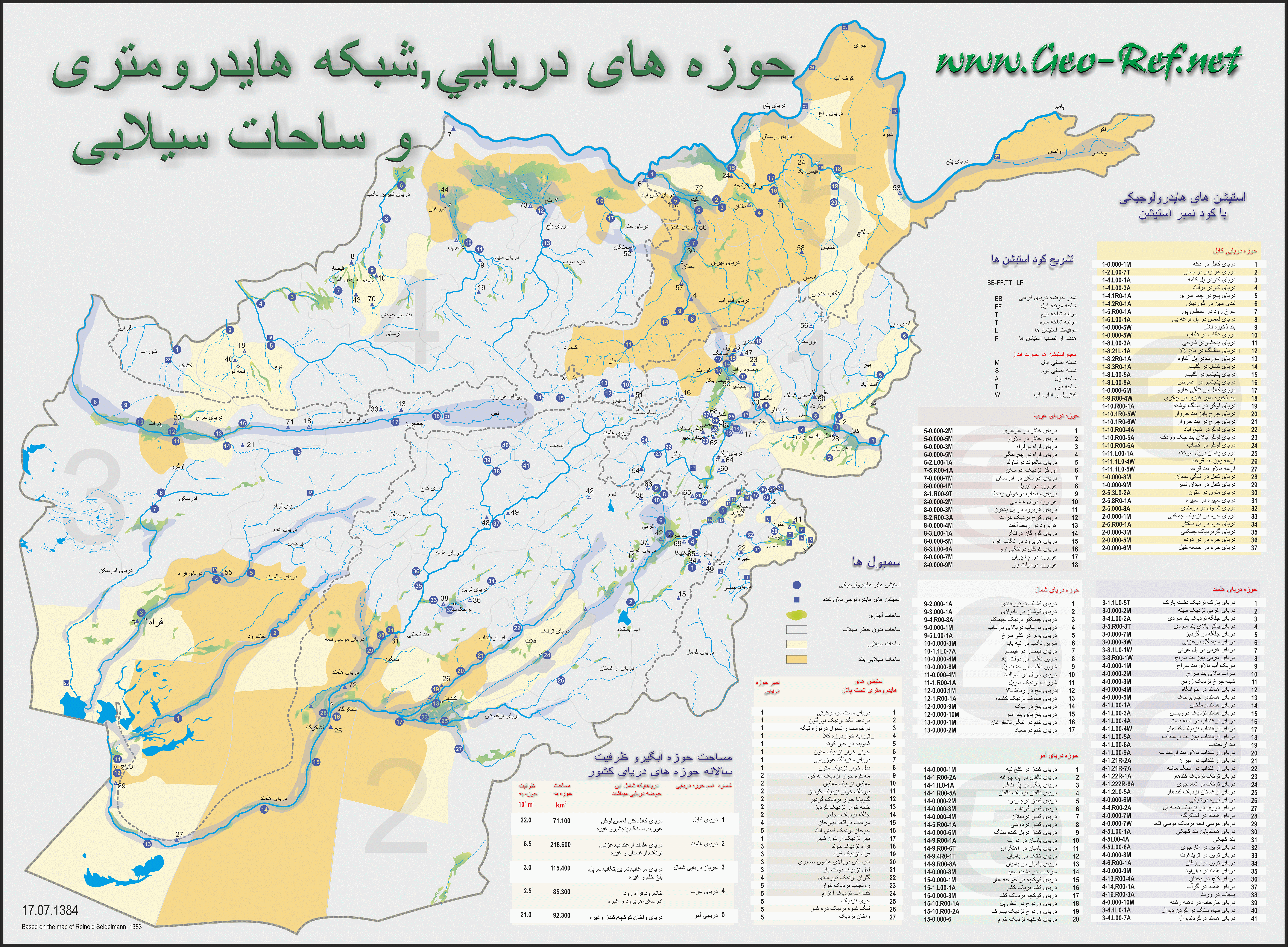
Elaboration of geographic maps and plans
Plans are visual presentations of technical o geographical contents
in schematic manner, giving so the user an easy entrance to the
technical or geographic problem – mapping it. This is starting with
simple technical schemas, like the map of the Kabul city network, shown
below, giving a local and simplified impression about the load flow,
showing the corresponding electrical stations. The simplification makes
more easy to understand the problem. Other
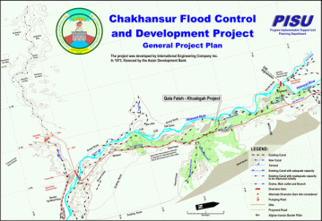
example is the flood regulation system, demonstrating the installations
over the real map of the region where the system is planned to
implement.
Click on the map to enlarge it!
The value of maps like these is the easy manner to visualize
the contents and to generate a better understanding of the technical
background. Maps like these are, especially if they are printed on
larger formats, a long time presentation of the project or the executing
institution, or like in the shown geographical project map of the unit
which has generated the map. One of my USAid colleagues has written me
last year that our maps are still on representative places used, and
this after more than 8 years …
Especially in a media society like ours is the animated virtual
reality for huger projects normal, but the most important decisions are
still taken on report base, and there these maps can make the difference
– giving a visual impression …
Please contact us for prices and conditions for the
elaboration of plans and maps like these.
|